


































































































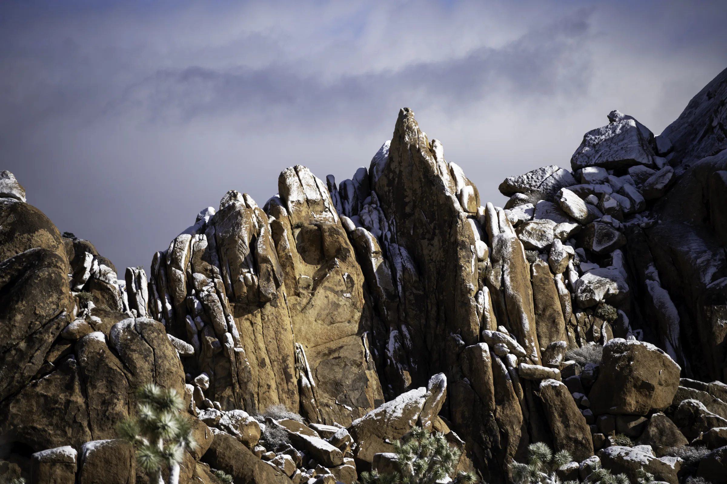
Joshua Tree
The Rock Formations of Joshua Tree
The big stacked boulders are the first thing most people photograph in Joshua Tree, and often the thing they remember longest. They pile up beside the road in rounded heaps, split into slots you can walk through, and balance in shapes that have earned their own names. This post explains how those rocks formed and where to find the well-known ones, from Skull Rock and Arch Rock to the maze called the Wonderland of Rocks. It is written for a day out of the house we keep about 25 minutes from the park's west entrance, so most of what follows is a short drive away.
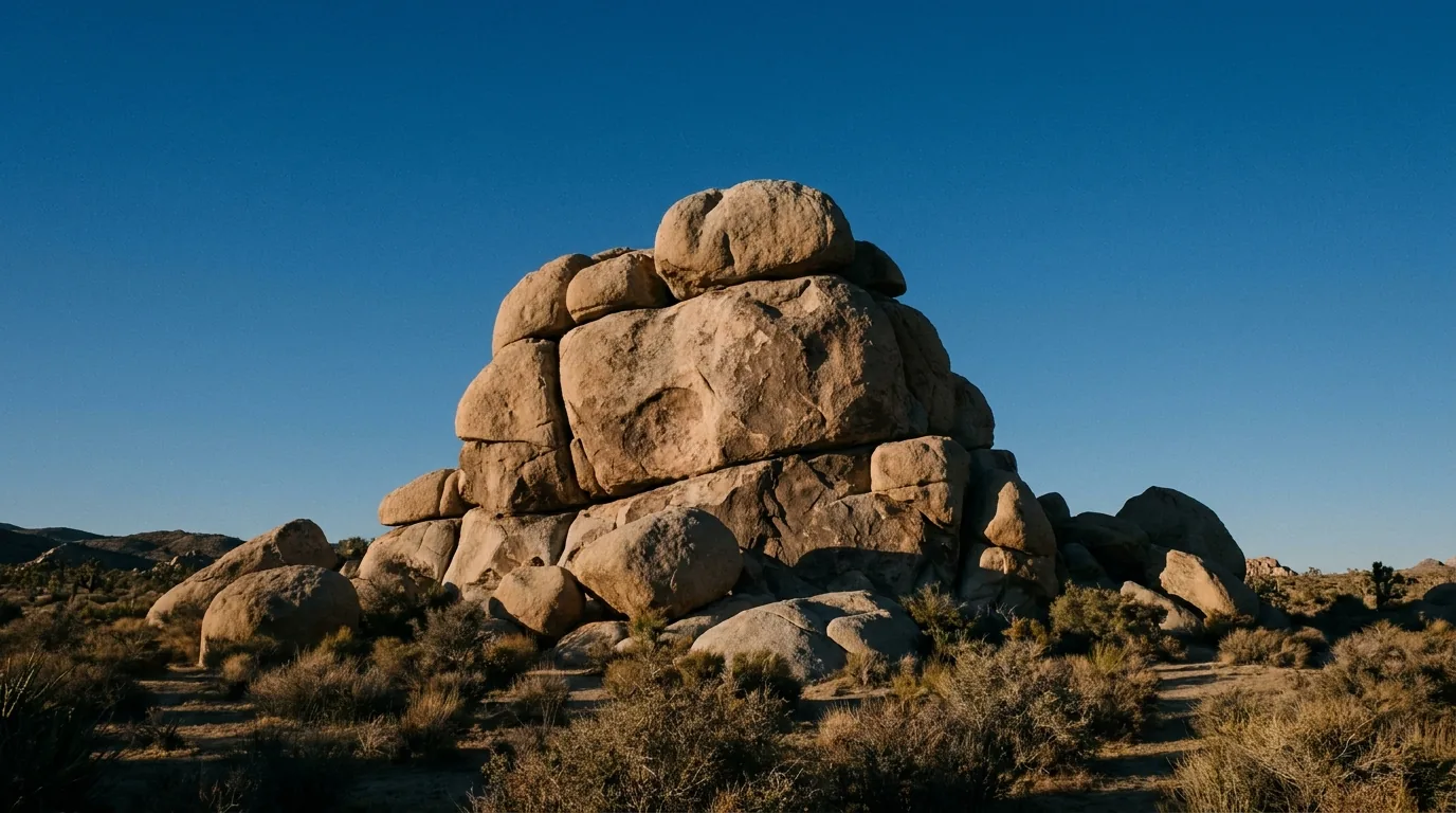
How the Boulders Formed
Almost every boulder you will scramble on in Joshua Tree is the same rock: monzogranite, a pale, coarse, biotite-flecked granite that geologists here call the White Tank monzogranite. It did not start out at the surface. It began as molten magma that pushed up through older crust and then cooled slowly while it was still buried miles underground, more than 100 million years ago. Because it cooled deep and cooled slowly, the crystals had time to grow large, which is why the rock looks grainy and feels grippy up close instead of smooth.
While that granite was still underground, it cracked. It developed three sets of rectangular fractures, called joints. One roughly horizontal set formed as the weight of overlying rock eroded away and the granite expanded upward, and two vertical sets crossed each other at steep angles. Those three sets together sliced the solid mass into rectangular blocks, a little like a stack of slightly offset bricks hidden inside the ground.
Then water went to work. In a wetter past climate, groundwater seeped down along all of those joints and chemically weathered the mineral grains along the block edges, turning them into soft clay. The corners and edges of each block broke down first, so the rectangular blocks slowly rounded into spheres of hard rock wrapped in a shell of soft clay. The park service compares it to the way water rounds the corners of an ice cube before it touches the flat faces.
The last step was exposure. When the regional climate dried into the desert we have now, flash floods stripped away the loose, weathered clay and soil that had surrounded the rounded rock. That left the hard granite spheres sitting where they were, often stacked one on top of another in the piles you see today. So the shapes were carved underground by water and then uncovered by erosion. Nothing was moved into place, nobody built them, and no two piles settled quite the same way.
It helps to know where in the park this boulder country sits. Joshua Tree takes in two deserts. The higher, cooler Mojave in the west and north is the Joshua-tree country, and it is also where the great stacked-granite piles concentrate: Hidden Valley, Jumbo Rocks, the Wonderland of Rocks, and the roadside formations strung along Park Boulevard. The lower, hotter Colorado Desert in the south and east trades the granite for ocotillo, cholla, and open creosote flats. Almost every formation in this post is in that western Mojave half, which is also the half you reach first from the west entrance and from the house, so a rock-focused day rarely means a long drive.
One naming note trips people up. Climbers have long called this rock "quartz monzonite," while the park's geology signs say "monzogranite." They are describing the same White Tank rock. And the pockmarks and hollows you will notice in so many boulders come from a slower version of the same process, where water pools in a low spot and eats a pit into the stone over a very long time. Those pits are worth remembering, because they are what gave Skull Rock its face.
Skull Rock
Skull Rock is one of the most photographed and recognizable boulders in the park, and it sits right beside the road so you do not have to hike to see it. You will find it along Park Boulevard next to Jumbo Rocks Campground. The name is honest: two deep hollows sit where eyes would be, with a rounded brow above and a jaw below, and from the right angle the whole boulder reads as a weathered skull.
Those "eye" hollows were carved by water. Rainwater collected in two low spots on the granite and, over many thousands of years, weathered pits down into the rock, the same tafoni-style pitting you see across the park in a smaller form. The skull shape is a lucky accident of where the water happened to pool, not anything carved by hand.
If you only want the photo, there is a roadside pull-out and you can walk right up to the boulder. Take care crossing Park Boulevard, because traffic here moves and this is one of the busiest stops in the park. If you want to stretch your legs, the Skull Rock Trail is an easy loop of about 1.7 miles round trip with roughly 160 feet of elevation gain, threading through boulder piles and washes before returning you to the road. Some sources round the loop closer to 1.8 miles, so treat any figure as approximate and check the current trail description on the park's site before you set out.
Skull Rock is best early. By mid-morning in the cooler months the pull-out fills, and in summer the granite radiates heat well past sunset. From the house it is a short enough drive that you can be standing in front of it not long after coffee, then be back for a swim before the day gets hot.
Arch Rock and the Twin Tanks Area
Arch Rock is exactly what it sounds like: a natural span of granite, formed the same way as everything else here, where weathering along the joints hollowed out the rock beneath a bridge of harder stone. It is a favorite for photographers because you can frame the desert, and after dark the Milky Way, through the opening.
Arch Rock is one of the classic night-photography subjects in the park for that reason. Joshua Tree was named an International Dark Sky Park in 2017, at the Silver Tier level, so on a clear, moonless night away from the entrances the Milky Way stands out cleanly, and the arch gives you a piece of foreground to set it against. The bright core of the Milky Way is an evening sight only from roughly late spring into early autumn, and it moves through the season, so check where it will be for your date before you plan a shot around it. For the seasonal detail, our post on the night sky over Joshua Tree lays out what is up when.
There are two ways to reach it, and it helps to know which you mean. The longer, marked route is the Arch Rock Trail, an easy lollipop loop of about 1.4 miles round trip with roughly 100 feet of elevation gain, which most people start from the Twin Tanks trailhead on Pinto Basin Road. There is also a much shorter spur, in the range of a third to a half mile, that reaches the arch from inside the White Tank Campground. Distances vary a little by source, so treat these as "about" figures and confirm the current trailhead and mileage with the park before you rely on them.
The Twin Tanks area around the trailhead is classic boulder country, with rounded piles good for a short scramble and washes that channel between them. It is quieter than Skull Rock, and the walking is gentle, which makes it a relaxed morning if you pair it with one of the other stops on the same side of the park. If you want more ideas for easy-to-moderate walks that string these formations together, our guide to the best hikes in Joshua Tree lays out the shorter loops by difficulty.
Because Arch Rock and Twin Tanks sit on Pinto Basin Road rather than the main Park Boulevard, they read naturally as the far end of a loop, or as the reason to keep driving south instead of turning back at Skull Rock.
Cap Rock
Cap Rock takes its name from the flat slab of granite balanced on top of the formation, sitting there like a cap on a head. It is one of the easiest stops in the park to reach and to walk. The Cap Rock Nature Trail is an easy loop of about 0.4 mile round trip with only around 20 feet of elevation change, with interpretive signs that explain the plants and the rock along the way.
The surface is worth knowing about if mobility is a consideration. The Cap Rock loop is hard-packed sand rather than pavement, roughly 36 inches wide, and the sand can be loose in places, so it suits some wheelchairs and walkers but not all. If you want a reliably paved, level walk instead, the Oasis of Mara at the north end and the short lower path at Keys View are the two most accessible options in the park, though part of the Oasis of Mara trail has been closed after flood damage, so check the park's alerts before you go.
Cap Rock also carries a piece of music history. After country-rock musician Gram Parsons died in September 1973 at the Joshua Tree Inn, his road manager and a friend took his body from Los Angeles International Airport, drove it out here, and attempted to cremate it by burning the coffin at Cap Rock. The partially cremated remains were found by authorities later that month. Cap Rock has been an informal pilgrimage spot for fans ever since, and you will sometimes see small tributes near the base. It is a real story, worth telling straight, and a reason this quiet, easy formation means more to some visitors than its size would suggest.
Jumbo Rocks
Jumbo Rocks is one of the areas the park service points to as a textbook example of the jointing-and-weathering process, alongside Split Rock and the Wonderland of Rocks. The name fits. This is a broad field of oversized rounded boulders, some the size of buildings, stacked and leaning against one another with sandy corridors and hidden pockets between them. It is one of the best places in the park to wander among big rock without a set destination.
Jumbo Rocks is also a campground, one of the park's nine, and it is on the reservation system rather than first-come, first-served, so campsites here book up well ahead in the cool season. If you are basing out of the house instead of camping, that is a comfortable trade: you get the boulders by day and a real bed, a full kitchen, and a stock-tank pool at night, without hauling water or fighting for a site. Only two of the park's campgrounds have drinking water at all, so day-tripping in and coming back to a pool and hot tub is an easy call in the heat.
Skull Rock sits at the edge of the Jumbo Rocks area, so the two pair naturally into one stop. Late afternoon is the reward here, when the low sun turns the granite warm and the corridors between the boulders fill with long shadows. Give yourself time to lose the trail a little; the fun of Jumbo Rocks is the poking-around, and there is no wrong way to explore it as long as you stay off the plants and keep track of where you left the car.
Split Rock
Split Rock is the third of the formations the park service names as a textbook example of the jointing-and-weathering process, alongside Jumbo Rocks and the Wonderland of Rocks. It takes its name from a single large boulder that cracked cleanly into two halves along one of the same joints that shaped everything else here. The split runs straight down a fracture plane, so you can stand at it and read the geology directly off the rock, right where the block came apart.
Split Rock is also the start of the Split Rock Loop, a moderate walk of about 2.5 miles round trip with roughly 150 feet of elevation gain that winds among boulder piles and washes before it returns to the trailhead. It is a step up from the short roadside stops in both length and effort, but it stays well within an easy morning, and it is usually quieter than Skull Rock or Jumbo Rocks. Distances vary a little by source, so treat the 2.5 miles as an "about" figure and check the current trail description with the park before you rely on it.
If you have already walked the marquee stops and want more boulder country with fewer people around, this is a good place to spend a slower hour. The loop threads close enough to the formations that there is plenty to scramble on if you feel like it, and enough open wash between them to keep the walking gentle if you do not. It also sits off the main Park Boulevard cluster, which is part of why it stays calmer than the roadside pull-outs even on a busy weekend.
Hall of Horrors
The Hall of Horrors is a roadside cluster of monzogranite formations between the Ryan and Sheep Pass campgrounds, and despite the name it is one of the more playful places to poke around. It is known for scrambling and for rock climbing, including a couple of narrow slot passages you can squeeze into between the rock walls. The name is old climbers' humor rather than anything sinister.
This is not a formal, measured trail. You explore it on short, informal dirt paths that wind in among the rocks, and the park service does not publish a set round-trip distance for it, so do not trust any exact mileage you see quoted for it. Park at the pull-out, walk in, and follow the use-paths toward whichever formation draws you.
The slots are the draw for a lot of visitors. Some are wide enough to stroll through and others tighten to a real squeeze, so know your comfort with narrow, enclosed rock before you commit to one, and back out rather than forcing it if a passage pinches down. The Hall of Horrors is also a busy spot for climbers working routes on the surrounding faces, so give roped parties room and watch where you put your hands and feet if others are on the rock above you.
Because it is quick to reach from the road and easy to dip in and out of, the Hall of Horrors is a good middle stop on a driving day, a place to burn twenty minutes of scrambling energy between the bigger sights.
The Wonderland of Rocks
The Wonderland of Rocks is the park's great labyrinth: a sprawling maze of quartz-monzonite domes and formations, some rising to around 300 feet tall, packed so densely that it is easy to lose your bearings inside it. It is one of the most striking landscapes in Joshua Tree and also one of the more serious to enter on foot, because there is no obvious grid and the rock all starts to look alike once you are deep in.
Most visitors meet the edge of the Wonderland from the Barker Dam Trail, an easy loop of about 1.1 miles round trip with roughly 50 feet of elevation gain that passes monzogranite boulders, a historic cattle-era water tank and dam, and a rock-art site with petroglyphs. Some sources put that loop closer to 1.3 miles, so take the number as approximate. The petroglyphs are fragile and legally protected; look, photograph if you like, and do not touch or trace them.
To push further in, the Willow Hole Trail follows sandy washes for about 7.2 miles round trip into the heart of the Wonderland. The park does not publish a firm net elevation figure for it, and it is a longer, more exposed outing than the roadside stops, so it calls for real water, sun protection, and a downloaded map. This is not a spontaneous late-afternoon wander; treat the interior of the Wonderland with the respect any trackless boulder maze deserves, and turn back with plenty of daylight to spare.
For a first visit, the Barker Dam loop gives you the scale of the place, the history, and the rock art without the risk of getting turned around, and it is one of the more rewarding easy walks in the park.
Scrambling and Bouldering Safely
Joshua Tree is a famous climbing destination, and the reason is the rock itself. The park is a monzogranite climbing mecca with more than 8,000 established routes, over 2,000 boulder problems, and hundreds of natural gaps, and it is known worldwide for traditional-style crack, slab, and steep face climbing on that grippy granite. You do not need to be a climber to enjoy it, though; plenty of the pleasure here is just scrambling up and over the rounded boulders on your own two feet.
A friendly place to start is the Hidden Valley area. The Hidden Valley Trail is an easy loop of about 1 mile round trip with roughly 100 feet of gain, circling a rock-enclosed valley that was once rumored to hide cattle rustlers, and the boulders around its edges invite low, casual scrambling.
You are not the only thing moving over these rocks, and a couple of the residents are worth knowing. The chuckwalla, a big plant-eating lizard, lives on exactly this kind of rocky outcrop, and its defense is a good one: startle one and it wedges itself into a crack between boulders and puffs up its body so nothing can pull it back out. The park's reptiles, 26 kinds of snake among them, are most active in spring and fall and shelter from the midday heat, so a warm morning is when you are most likely to share a boulder with one. Sidewinder rattlesnakes keep mostly to the sandy washes below the rock and move at dusk and after dark in the warm months. So watch where you put your hands and feet: look before you push a hand into a shaded crack or set a foot down onto a ledge you cannot see.
The single most useful piece of scrambling advice: going up is easier than coming down. The rough granite gives your shoes a lot of grip and it is easy to climb higher than you can comfortably reverse, especially on rounded rock where you cannot see your footholds below you. Pick lines you know you can descend, downclimb facing the rock, and do not commit to a move you cannot undo. A few other things worth keeping in mind:
- Cell service is very limited. Reception inside the park is unreliable and should never be counted on, so download offline maps before you arrive and tell someone your plan.
- Bring your own water. There is no water in the park interior; a common guideline is at least one gallon per person per day, and more in summer heat.
- Mind the season and the wildlife. Summer days routinely top 100°F, and warm months are when snakes are active on and around the rocks, so watch where you place hands and feet.
- Leave the rock as you found it. Collecting rocks, plants, or anything else is prohibited, and vehicles must stay on established roads. Everything stays where it is for the next person.
If you want to go beyond scrambling into real roped climbing or bouldering, our rock climbing guide for Joshua Tree covers the classic areas, when to go, and how to link up with local guides and gear.
Photographing the Boulders
The granite here photographs best at the ends of the day. In the hour after sunrise and the hour before sunset, low light rakes across the boulders, warms the pale rock to gold and amber, and throws long shadows that show off the texture and the stacked shapes. Midday sun flattens everything, so plan the marquee stops, Skull Rock and Jumbo Rocks especially, for early or late. Put a person in the frame when you can; the boulders are so large that a photo has no sense of scale until there is a human standing at the base.
After dark the rocks become foreground for the sky. Joshua Tree was designated an International Dark Sky Park in 2017, at the Silver Tier level, and on a clear night away from the entrances the Milky Way stands out over the formations. For a nightscape, a common starting point is a wide, fast lens in the 14 to 24mm range at f/2.8 or wider, an ISO somewhere around 1600 to 6400, and single exposures of roughly 15 to 25 seconds on a fixed tripod. Those are starting points, not fixed settings; the right numbers depend on your lens, your camera, and how dark the sky is that night. The "500 rule" gives you a rough ceiling before the stars start to trail: divide 500 by your focal length in millimeters, so a 20mm lens gets you about 25 seconds. Give your eyes 20 to 30 minutes in the dark to adjust, and use a dim red light so you do not reset that adaptation every time you check your gear.
"photo-worthy spots everywhere" — one review
You do not have to be in the park to shoot the night sky, either. Back at the house, the fully fenced desert lot, the stock-tank pool, and the restored 1950s car turned into an open-air bed all sit under the same dark sky, and the car bed's custom stargazing roof can be pulled back so you can lie there and watch. For a deeper walk through camera settings, timing, and the best foregrounds, see our post on photographing Joshua Tree.
Planning a Short Driving Loop
Park Boulevard is the spine that connects the famous rocks, so a good day is just one road with well-chosen stops. The West Entrance, the busiest one, sits at Joshua Tree Village about five miles south of where Highway 62 meets Park Boulevard, and from the house that entrance is roughly a 25-minute drive. There is no timed-entry ticket or reservation needed to drive in as of 2026, and the park is open 24 hours a day, every day. The entrance fee is around $30 per vehicle for a seven-day pass, but fees change, so confirm the current figure with the park before you go.
Timing matters as much as the route, mostly because of heat. Summer days routinely top 100°F, and bare granite holds that heat well past sunset, so a July boulder walk is an early-morning outing or nothing. The cooler stretch from about October through May is the comfortable window, and it is also the busy one; spring, roughly March through May, is the most crowded time of all, both for the mild weather and for the wildflowers, so the roadside pull-outs fill early. Fall is popular and a little calmer. Winter is quiet, and the days stay cool and clear, though nights can drop to freezing, which is worth a jacket if you linger for the stars. Whichever season you come, the granite is best photographed at the ends of the day, and the middle of a summer day is best spent back at the pool.
A simple first-visit order, entering from the west, runs like this: start at Hidden Valley for an easy loop and a warm-up scramble, continue to Cap Rock (with the short spur out to the Keys View overlook, at roughly 5,185 feet, if the day is clear), stop at the Hall of Horrors to duck through the slots, then reach Jumbo Rocks and Skull Rock for the biggest boulder field and the park's signature photo. If you have the legs for one more, the Split Rock loop nearby adds a quieter couple of miles among the boulders. From there you can keep going south onto Pinto Basin Road to finish at Twin Tanks and Arch Rock, or turn back the way you came. Our first-timer's route through the park walks the same drive in more detail.
Two practical notes make or break the day. First, there is no gas, water, food, or lodging inside the park, so fuel up and fill your water in Yucca Valley, the town of Joshua Tree, or Twentynine Palms before you enter, and carry more water than you think you need. Second, because cell service is unreliable, download your offline map ahead of time; our getting here page has the directions and the last places to stop for supplies on the way in.
When you have had your fill of granite, the house is the easy landing at the end of the drive. You can rinse the dust in the stock-tank pool under the painted "Endless Summer" sign, cook in the full kitchen or fire up the outdoor grill, and sit out by the gas fire pit ringed with natural boulders once the heat drops. There is even a dining table built around a natural boulder, so you can trade rock for a while and then come right back to it over dinner, which we wrote about in slow mornings at the boulder table. To pin down your dates for a boulder-hunting trip, check the calendar and book a stay, and read the house details so you know exactly what is waiting when you drive back through the gate.