


































































































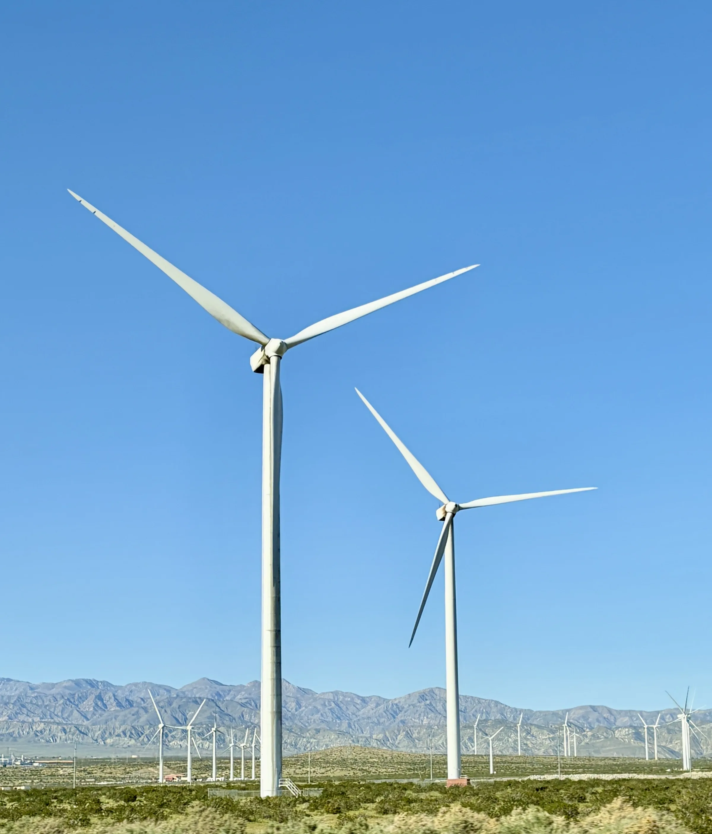
Practical
Driving to Joshua Tree
Most trips to Joshua Tree end the same way: a climb off Interstate 10, a turn onto Highway 62, and the land opening up as the road gains a few thousand feet of elevation. Stargaze Escape sits in Yucca Valley, about a 25-minute drive from the park's west entrance, so wherever you set out from, the drive is the first real part of the trip. This is how to reach the high desert from Los Angeles, San Diego, Orange County, Las Vegas and Phoenix, which airport makes sense, and what the road and the desert ask of your car once the towns thin out.
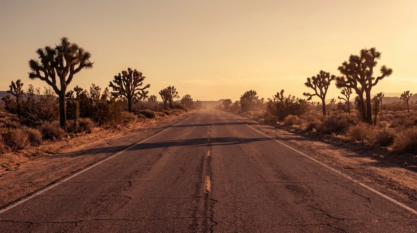
The road in on Highway 62
Nearly every route to Yucca Valley funnels onto one road at the end: California State Route 62, the Twentynine Palms Highway. It is the main east-west artery through the Morongo Basin. It leaves Interstate 10 near Whitewater, just west of Palm Springs, then climbs through Morongo Valley before it reaches Yucca Valley, the town of Joshua Tree and Twentynine Palms, running along the park's north boundary the whole way. If you learn one piece of local geography before you come, learn Highway 62, because your last half hour will be on it no matter where you started.
Yucca Valley sits at roughly 3,300 feet in the high Mojave Desert, well up above the low desert around Palm Springs. That elevation is why the summers here run cooler than the low desert around Palm Springs, and it is why the last stretch of any drive is a steady climb up out of the low desert. From Yucca Valley, the town of Joshua Tree is only about 7 miles east, roughly a 12-minute drive further along Highway 62. The house is about 25 minutes from the park's west entrance and about 50 minutes from Palm Springs, so it works as a base whether you are heading up into the park or down the hill for a day in the low desert.
One thing worth knowing before you drive it is that the park itself takes in two deserts, and the corridor you arrive on runs right along the seam between them. The western and northern side, where Yucca Valley and the town of Joshua Tree sit, is the higher, cooler Mojave, the country of the Joshua trees themselves. The eastern and southern side, down toward the South Entrance and Interstate 10, is the lower, hotter Colorado Desert of ocotillo, creosote and cholla. That is why the same trip can feel like two different landscapes depending on which way you come in, and why the west-side towns near the house stay a little cooler than the valley floor around Palm Springs. Keep it in mind when you plan your final approach, because the climb you make at the end is the climb up out of the low desert into the high one.
It helps to know the park has three entrances before you plan your final turn. The West Entrance, at Joshua Tree village about five miles south of where Highway 62 meets Park Boulevard, is the busiest and the closest to the house, which is why most guests use it. The North Entrance is in Twentynine Palms, about three miles south of the Highway 62 and Utah Trail junction, and it is the quieter way in if you are staying near that end of the basin. The South Entrance, near Cottonwood Spring, is a different animal: it opens off Interstate 10 about 25 miles east of Indio, which makes it the entrance closest to the Coachella Valley and Palm Springs side. Our full notes on the arrival live on the getting here page, and the Highway 62 guide walks the corridor town by town so you know what you are passing.
From Los Angeles
Los Angeles to Yucca Valley is roughly 120 miles, and in clear conditions it takes about two to two and a half hours. The usual route is Interstate 10 east across the basin, then north on Highway 62 at the Whitewater junction. Treat that drive time as a starting figure and check current traffic before you leave, because the LA basin can add a good deal to it. A weekday afternoon, or a Friday heading into a holiday weekend, can push the trip well past three hours, and the same congestion that slows the freeway can bunch up again at the base of the Highway 62 climb.
The single most useful thing you can do from LA is time your departure. Leaving early on a weekend morning, or waiting until the evening rush thins out, keeps you off the worst of the I-10. The drive is not scenic for its first couple of hours; it is a long run through the inland valleys past Riverside and Banning. It changes character at the very end, when you make the turn onto Highway 62 and start the climb, and the freeway noise falls away. Have your food and fuel plan set for the flat part, so the last hour is just the drive. A playlist for the drive out helps the miles across the basin, and if you are still shaping the trip, our trip-planning notes cover what to line up before you go.
From Orange County and San Diego
From Orange County you are looking at roughly 110 to 130 miles depending on where you start, and about two to two and a half hours. Drivers usually take State Route 91 or State Route 60 to reach Interstate 10, then follow it east to Highway 62. That number is an estimate stitched together from the shared I-10 corridor rather than a single fixed route, and it swings hard with traffic, so check your own start point the morning you leave rather than trusting a round figure. The 91 in particular can be slow, and some drivers time their run to avoid it.
San Diego is a little farther, about 150 miles and roughly two and a half hours. The common line is Interstate 15 north to pick up the Interstate 10 and Highway 62 corridor. Both of these drives share the same last act as the Los Angeles route: a long, flat run across the inland valleys, then the turn north and the climb up into the Morongo Basin. Fuel, coffee and food are easy to find all along Interstate 10, and they get noticeably sparser once you are on Highway 62 above Morongo Valley. If your tank is low, top it off before you leave the interstate, because the gap between the freeway services and the gateway towns is open desert, with no gas or food until the gateway towns.
From Las Vegas
Las Vegas to Yucca Valley is about 200 miles and, in ordinary conditions, roughly three and a half hours. Most drivers take Interstate 15 south and cut across to the Morongo Basin, and that is the fast, predictable choice. There are longer desert alternates for people who want the drive itself to be part of the sightseeing: one runs through Amboy on old Route 66, and another drops down the eastern end of the Twentynine Palms Highway into Twentynine Palms and then west along Highway 62. Both trade speed for empty road and long gaps between services.
If you take the Route 66 line, treat it as its own small expedition rather than a shortcut. Fuel up before you commit to it, carry more water than you think you need, and do not count on cell coverage between towns. We wrote about that stretch and its landmarks in the Amboy Crater and Route 66 guide, so you know what is worth stopping for and what is just distance. Whichever way you come down from Nevada, confirm the current drive time before you set out, since roadwork on I-15 and desert weather can both change it by an hour or more.
From Phoenix and the east
Phoenix and the rest of the east arrive on Interstate 10. Phoenix to the Joshua Tree area is roughly 280 to 290 miles and about three and a half to four and a half hours, almost all of it on I-10 west until you reach Highway 62. It is a long, steady desert freeway drive with predictable services, so the main job is planning your fuel and rest stops and checking the day's conditions before you lock in a departure time. Summer heat on that route is no joke, and it is worth starting early to keep the car and the driver fresh.
Coming from the east gives you one option the western routes do not have. Because the park's South Entrance opens directly off I-10, about seven miles north of exit 168 and roughly 25 miles east of Indio, you can enter the park at Cottonwood and drive up and out through the middle of it, reaching Yucca Valley by way of the park itself instead of staying on the freeway. That turns the final leg into a scenic crossing past the Cholla Cactus Garden and up through the Pinto Basin, with the landscape shifting from the lower Colorado Desert to the higher Mojave as you climb. The Cholla Cactus Garden itself is a short quarter-mile loop through a dense stand of teddybear cholla; it looks soft and is anything but, since the stem segments detach at the lightest touch and hitch onto skin and clothes, so admire it from the path and keep your hands off. Farther south you pass the ocotillo and creosote of the Colorado Desert before the road lifts into the Joshua trees of the higher Mojave. It is a long crossing of the park with no fuel, water or services of any kind, and it means paying the entrance fee on the way in, so save it for a day when you are not racing the clock and top off in Indio or the gateway towns before you go in.
Airports near Joshua Tree
The closest airport is Palm Springs International (PSP), roughly a 45-minute to one-hour drive from Yucca Valley and the west entrance. It is the easy choice when the flights and fares line up, and it keeps you out of Los Angeles traffic entirely. Treat that drive time as approximate and pad it for the Highway 62 climb, which is the same climb every ground route makes at the end.
Ontario International (ONT) is the next option, about 80 to 85 driving miles west, or roughly one and a quarter to one and three-quarter hours. It usually offers more flights than Palm Springs while still avoiding most of the LA congestion, which makes it a sensible middle ground when Palm Springs is expensive or inconvenient. From there the farther choices open up:
- Los Angeles International (LAX). Around two and a half hours to Yucca Valley when traffic cooperates, and it cooperates less often than you would like.
- San Diego International (SAN). A similar two and a half hours or so by road, worth it mainly if the fares beat the closer airports.
- Harry Reid International, Las Vegas (LAS). About three and a half hours by road, the same as driving from the city itself.
Whichever you choose, plan on a rental car. There is no public transit into the park, the sights are spread across many miles of open desert, and the house has free parking waiting for you when you arrive. All of these airport times are travel-site estimates that shift with traffic and the season, so confirm your own route before you book a tight connection. If you fly into Palm Springs, the drive up the hill is short enough that many guests break it up with a stop in the low desert; the Palm Springs day-trip guide has ideas for that first afternoon.
Where to stop before the park
The three towns along Highway 62 are the last real services before the park, so most guests treat the drive in as the moment to stop for coffee, food and water. Yucca Valley is the largest and has the most of everything; the town of Joshua Tree, about 7 miles east, is smaller and sits closest to the west entrance; Twentynine Palms is farther east, near the North Entrance, at the far end of the basin from the house. Coming to Stargaze Escape you reach Yucca Valley first, which makes it the natural place to load up before you settle in.
For coffee and a first meal, a few long-running spots are worth knowing. Frontier Cafe, on the western edge of Yucca Valley, pours organic coffee made with beans from a local roaster and does pastries, sandwiches and breakfast, with a dog-friendly patio if you have the pup along. In the town of Joshua Tree, Crossroads Cafe is a classic American diner near the west entrance with scratch breakfast and lunch, and JT Country Kitchen is a small home-cooking breakfast and brunch spot billed as the village's longest continuously operating restaurant, going back to 1977; no reservations. Joshua Tree Coffee Company roasts its own organic small-batch coffee a short way down the same highway if you want beans for the kitchen at the house. Hours in the high desert tend to run short and seasonal, and places open and close, so check a spot's own website or call ahead before you build a morning around it. Our coffee in the high desert guide rounds up more of them.
For provisions, Yucca Valley has a pair of Stater Bros markets right on Highway 62, which is where most guests stock the kitchen for the stay so they are not driving back for milk. On Saturday mornings the town of Joshua Tree holds a certified farmers' market downtown, roughly 8am to 1pm, with local produce and baked goods; it is seasonal and weather-dependent, so confirm it is running before you plan around it. Fill your water bottles while you are in town as well. Drinkable water in and around the park is limited to a few developed points near the edges, such as the Joshua Tree National Park Visitor Center in downtown Twentynine Palms, the Black Rock Nature Center at the Yucca Valley end, and the Cottonwood Visitor Center in the south; there is none in the interior, so it is easier to arrive already carrying what you need.
Electric vehicles and fuel
The most important fuel rule for Joshua Tree is a plain one: there are no gas stations inside the park, and no restaurants, stores or hotels either. You fill up in the gateway towns before you drive in, and you plan to make it all the way back out on that tank. The park roads are long, the interior has little to no cell signal, and running low out there is a problem you do not want to solve from the shoulder. The three towns strung along Highway 62 are where you handle all of this: Yucca Valley, the town of Joshua Tree, and Twentynine Palms each have fuel, and Yucca Valley has the full grocery stores to stock the kitchen at the house on the way in.
Electric vehicles follow the same logic, only more so. There is nothing to charge inside the park, so arrive at the boundary with plenty of range and treat any in-park driving as round-trip miles on the charge you brought. Charger locations and networks in the high desert change often, so check a current charging app such as PlugShare for what is actually live near Yucca Valley and down in the Palm Springs area before you depend on it, rather than assuming last year's stations are still there. The low desert around Palm Springs generally has denser charging infrastructure than the high desert, so if charging is central to your trip, plan your top-ups down the hill and confirm the current situation before you come. The house has free on-site parking. A short checklist for the last town before the park:
- Fuel or charge to full. The next reliable services are back in the gateway towns, so leave with range to spare.
- Water. Buy more than you think you need; there is none in the park interior.
- Groceries. Provision in Yucca Valley for the whole stay so you are not making the drive back for milk.
- Offline maps. Download them while you still have signal, for the park and for the house.
Park fees and passes
One more thing to sort before you reach the gate is what you will pay to get in. A private vehicle pass is around $30 and covers everyone in the car for seven days, so a single pass usually carries a whole visit; motorcycles and people arriving on foot or by bicycle pay less. If you come often, the park sells its own Joshua Tree annual pass for around $55, and the federal America the Beautiful interagency pass, which is good at national parks and other federal sites, runs about $80 for U.S. residents. For 2026 the park service introduced separate, higher pricing for non-residents, and entrance fees are revised from time to time, so treat all of these as ballpark figures and check the current rates with the park before you go. A few passes, including the ones for active military, fourth-graders and visitors with an access pass, are free, so check before you pay.
You do not need a timed-entry ticket or an advance reservation to drive into Joshua Tree, at least as of 2026. Unlike some crowded parks, it has no online entry system, so you can turn up and go in. The park is open 24 hours a day, every day of the year, and when the entrance stations are unstaffed at night the gates stay open, so an early arrival or a late one is no trouble. If you roll in after the booth closes, hold on to your pass or receipt, and if you are entering on a busy morning, expect a short line of cars at the west entrance station, which is the busiest of the three.
The park also runs a handful of entrance-fee-free days each year, tied to dates such as Presidents Day, Memorial Day and Veterans Day. The exact list is re-set every year, though, and some of the newer patriotic dates are now designated for U.S. residents only, so do not reuse last year's calendar; check the current-year list on the park's site if you are trying to line your trip up with one. Bear in mind that a fee-free day is also one of the busiest days at the entrance stations, which is worth weighing against the saving.
The last stretch and losing signal
The last part of every route is the same: the climb off Interstate 10 onto Highway 62, up out of the low desert and into the Morongo Basin. Somewhere on that climb your phone signal starts to thin, and inside the park it becomes very limited and should never be relied on. The park service tells visitors to download offline maps before they arrive; the free NPS app lets you save the park map to your phone, and it is worth doing for the whole area rather than the park alone, since coverage is patchy across the basin.
Do the same for the house. Pull up the driving directions and save them, or take a screenshot, before you leave good coverage, because GPS out here sometimes tries to route you onto a dirt road or loses the thread on the smaller streets near the end. Our getting here page has the exact directions and the landmarks for the final turns, so download it before you go quiet. Once you are parked on the gravel the house has wifi and you can get your bearings again, but the drive in is not the moment to be hunting for a bar of signal in the dark.
Arriving after dark is common, and it has an upside. Joshua Tree was named an International Dark Sky Park in 2017, and the same darkness that makes the stars so good on this side of the basin means the roads near the house have very little light. That designation was given at the silver tier, which stands for excellent skies that still catch some light-dome intrusion from the metro areas around the basin; the biggest glows come from Los Angeles, the Coachella Valley and Las Vegas. In the darker interior the sky reaches roughly Bortle class 2 to 3 on the nine-point scale astronomers use, dark enough to show the band of the Milky Way to the naked eye, while the boundaries and western entrances read a little brighter. For the drive itself the effect is plain: once you leave the towns there is very little ambient light, and your headlights are doing all the work.
Drive the last few miles slowly, use your high beams where it is safe, and give yourself a minute once you are parked. If you want to actually see the stars rather than just glance up, give your eyes twenty to thirty minutes to adjust to the dark, and use a dim red light instead of a phone screen or a white flashlight, since a single look at white light resets that adjustment. The sky over the gravel where the car bed sits is a reasonable first taste of why people come.
Driving in the desert safely
The high desert is not a hostile place to drive, but it is an empty one, and a few habits keep it safe. Carry water. The park has none in its interior, and the standard guidance is at least a gallon per person per day for the people; in summer it is worth keeping a few extra gallons in the car for the vehicle as well. The park service asks drivers to stay on designated, established roads, and off-road and cross-country driving is prohibited to protect the fragile desert soil and plants. It is also practical advice, because the soft, sandy shoulders will trap a car that pulls off too far, and a tow out here is a long wait.
Heat is the real hazard in the warm months. Daytime highs regularly top 100°F, with July averaging a high near 96°F, and a car with a marginal cooling system will feel it on the climbs. Winter flips the problem: days are cool, often in the upper 50s to low 60s, while nights can drop below freezing, so watch for cold, icy early mornings on shaded pavement. Snow is rare, though a light dusting does happen once in a while. In the middle and late summer, brief monsoon thunderstorms can move through and set off flash flooding. If you reach a wash running with water across the road, wait it out rather than driving into it, because desert floods rise and drop quickly and the depth is hard to judge.
Watch the roadsides at dawn and dusk, when the desert is most active. Coyotes are common across the park and are generally most active at dawn, dusk and after dark; bobcats and the small, nocturnal desert kit fox move at those same hours, and you may pick up a black-tailed jackrabbit or a desert cottontail in the headlights. The Mojave desert tortoise is the one to slow for on purpose. It spends most of its life underground and is rarely seen, but in the warmer months it comes out to forage and can end up resting on warm pavement; it is a threatened species, and it is illegal to handle or move one. If you find a tortoise in the road, stop, give it room, and let it cross on its own rather than picking it up. In warm weather you may also see a snake stretched across the pavement at dusk, including the sidewinder rattlesnake of the sandy flats, so give it the same wide berth. For what to keep in the car and on your person, our packing guide and our notes on desert safety and leave no trace go deeper than there is room for here.
The drive home
Plan the return the way you planned the arrival. Fill the tank or charge before you leave town, since the last reliable services are back in Yucca Valley, Joshua Tree and Twentynine Palms. If you are headed to Los Angeles, Orange County or San Diego, the same traffic that slowed you coming out will be waiting for you going back, so aim to clear the Interstate 10 stretch before the afternoon builds or after the evening rush settles. A mid-morning departure after a slow breakfast, or a later one after an early dinner, usually beats leaving at three in the afternoon and sitting in the basin.
There is a good case for staying one more night rather than rushing the drive back. The park is open 24 hours a day, year round, and no timed-entry reservation is required to drive in, so an early morning or a late evening in the park costs you nothing beyond the entrance fee covered above. A last swim in the stock-tank pool, an hour by the gas fire pit ringed with boulders, or a final stretch under the stars from the car bed parked on the gravel all make the long drive home easier to face in the morning.
"Photo-worthy spots everywhere." — one review
When you are ready to set the dates, you can check availability and book directly for the whole house, both king bedrooms and the fenced desert lot to yourselves. If you are still working out the shape of the trip, which days, which season, what to see first, read what to know before you visit Joshua Tree next, and then point the car toward Highway 62 with a full tank and a gallon of water per person before you leave the last town behind.