


































































































Getting here
Flying into Ontario
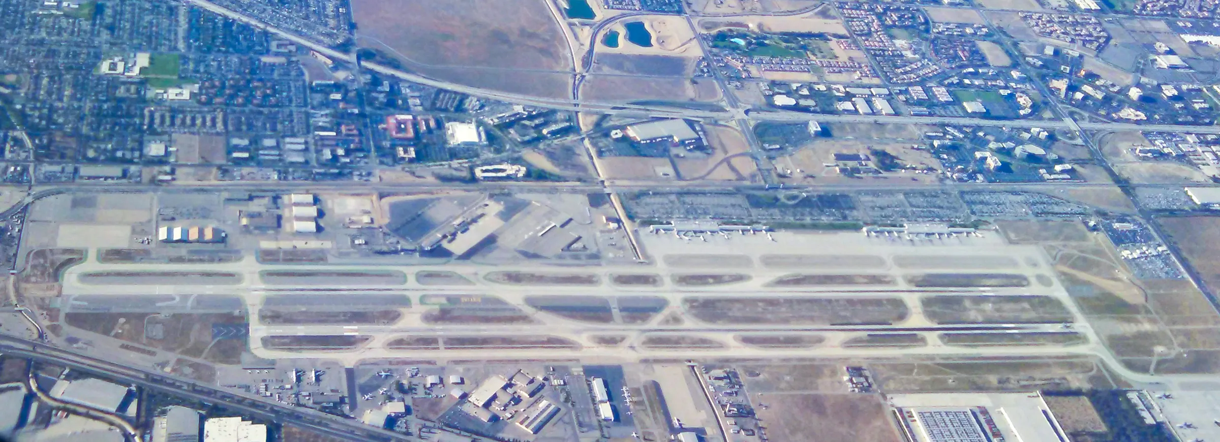
Ontario International Airport, in the Inland Empire east of Los Angeles, is about 95 miles from Stargaze Escape. It carries more than twice as many passengers as Palm Springs and starts you east of the Los Angeles basin, so the drive is mostly one freeway and two highways. Here is what flies there, how to reach the rental cars, and what the drive out Interstate 10 and up Highways 62 and 247 looks like.
Why fly into Ontario
Ontario sits about 38 miles east of downtown Los Angeles, at 944 feet above sea level. It handled about 7.1 million passengers in 2025 and is allowed to operate around the clock. Since November 2016 it has been run by the Ontario International Airport Authority, a joint venture of the City of Ontario and San Bernardino County. For scale, LAX handled about 76.6 million passengers in 2024, so Ontario sees roughly a tenth of the traffic and is a much smaller place to find your way around.
For a trip to the high desert, its advantage is position. By our routing, LAX is about 147 miles from the house and Ontario about 94, and nearly all of Ontario's miles are on a single freeway that skips the busiest part of the Los Angeles basin. Palm Springs is closer again, about 40 miles from the house, but many of its routes run only from fall to spring. In summer especially, look at Ontario if Palm Springs has no flight for your dates.
Terminals and airlines
Ontario has two passenger terminals, numbered 2 and 4, with 12 and 14 gates. At the time of writing, the airlines split like this:
- Terminal 2. Alaska, Avianca El Salvador, China Airlines, Delta, Frontier, United and Volaris.
- Terminal 4. American, JetBlue, Southwest and STARLUX.
Note which terminal your airline uses before you head back for the flight home. Each terminal has an Aspire lounge and duty-free shopping, and both added new restaurants for 2026. Ontario also has a handful of international routes that are unusual for an airport its size. Volaris flies to Guadalajara and has added Mexican cities including Los Cabos, Morelia and León. China Airlines and STARLUX fly to Taipei, and Avianca El Salvador flies to San Salvador. Routes like these come and go, so confirm them with the airline. International flights pull up at a small international arrivals facility with two arrival-only gates and U.S. Customs, so the walk from the plane to passport control is short.
The domestic schedule grew again for summer 2026. The airport's announcements for the season listed new daily Alaska flights to Boise and Santa Rosa, a new Southwest route to Honolulu, daily Frontier service to Houston and San Francisco, more Delta flights to Atlanta and Seattle, and JetBlue service to New York's JFK running through the fall. Routes start and stop often, so check the airport's website or your airline for what is flying on your dates.
Getting to the rental cars
All of the on-airport rental companies share one rental car center on East Airport Drive near Haven Avenue, at the east end of the airport. Collect your bags, go down to the lower level, and walk outside to the shuttle stop; the free bus is signed GTC-Car Rentals. Shuttles come about every 5 to 20 minutes, less often late at night.
Build the shuttle ride and the counter into your timing, especially if you land at a busy hour. If someone in your party is coming by train instead, Omnitrans route 380, the ONT Connect, runs nonstop between the airport and the Rancho Cucamonga Metrolink station, a handy place to meet up before the drive east.
East on Interstate 10
As Southern California drives go, this one is simple. From the airport, take Archibald Avenue to I-10 east and stay on it for about 61 miles, through Fontana, Colton, Redlands and Yucaipa, over the summit at Beaumont and down past Banning and Cabazon. Leave the interstate at the Highway 62 exit near the bottom of the pass and follow 62 north for about 20 miles to Yucca Valley. There you turn north on Highway 247 (Old Woman Springs Road) for about 9 miles to Flamingo Heights.
A routing engine puts the trip at about 84 miles and an hour and 45 minutes from the airport to central Yucca Valley, and about 94 miles and two hours to the house. Travel-site estimates for the run to Yucca Valley range from about an hour and a quarter to an hour and three quarters. All of those figures assume moving traffic, which brings us to the main variable.
Traffic in the Inland Empire
Ontario spares you the Los Angeles basin, but I-10 east of the airport is a busy commuter and truck route in its own right, and the time estimates above can grow by half an hour to an hour or more in Southern California traffic. Weekday late afternoons are the time to avoid. In Beaumont, Highway 60 merges into I-10, adding the traffic coming from Riverside and Orange County. In April, Coachella usually fills two consecutive weekends at the Empire Polo Club in Indio and Stagecoach the weekend after, and a good deal more of the freeway is headed the same way you are; our page on Coachella and Stagecoach covers those weekends. Our journal post on driving to Joshua Tree has more on timing the trip from the city.
The most useful tool is Caltrans QuickMap, which shows live speeds, closures and construction on state highways and interstates. Look at it before you leave the rental car center, then let your map app handle the rest. If you land in the late afternoon on a weekday, a meal near the airport and a later start can make for a calmer drive than joining the evening rush straight away.
The San Gorgonio Pass
The most striking part of the drive comes about 40 miles from the airport, where I-10 squeezes through the San Gorgonio Pass. The summit, about 2,600 feet up, is in Beaumont, with the San Bernardino Mountains to the north and the San Jacinto Mountains to the south. It is one of the deepest mountain passes in the contiguous United States. The peaks on either side stand nearly 9,000 feet above the pass, and the face of Mount San Jacinto rises just six miles from the freeway.
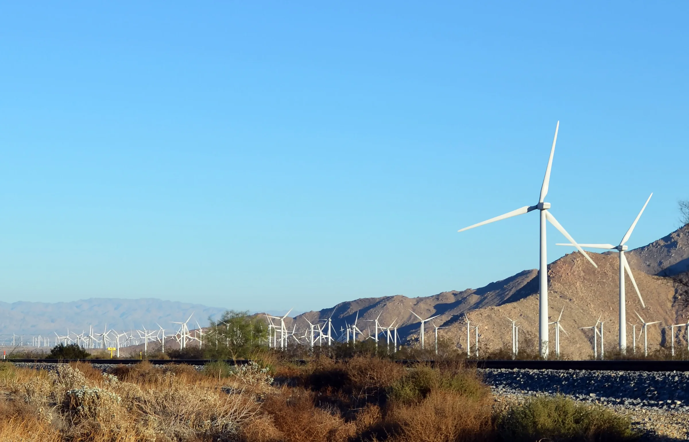
The San Andreas Fault runs roughly alongside I-10 through here, and geologists describe the pass as the single largest discontinuity along the fault. The railroad beside the freeway, now Union Pacific, carries freight and Amtrak's Sunset Limited and Texas Eagle. The pass also channels wind between two very different climate zones, which is why wind turbines appear as you drop toward the desert floor beyond Cabazon. From the summit the road loses height toward the Highway 62 exit, and then Highway 62 climbs back up to Yucca Valley at roughly 3,300 feet, well above the pass itself.
Stops before Highway 62
Cabazon, just east of Banning, is the easy place to stretch your legs, and two long-running roadside businesses sit right off the freeway:
- Hadley Fruit Orchards. Founded in 1931 by Paul and Peggy Hadley, it sells dates and dried fruit, nuts, butters and jams, honey and baked goods, and has a cafe. At the time of writing it lists hours seven days a week, from morning into the evening.
- Cabazon Dinosaurs. Dinny and Mr. Rex, the two giant roadside dinosaurs, along with more than 100 smaller ones, a dig area and gemstone panning. One of the gift shops is inside the belly of the Apatosaurus. Tickets are sold only at the door, and it posts its hours by day of the week on its website.
Both make a good break with kids or after a long flight. A third stop suits people who would rather walk than shop: about three miles before Highway 62, the Whitewater exit (exit 114) leads up Whitewater Canyon Road, roughly 5 miles, to Whitewater Preserve, a canyon where the Whitewater River runs all year below the San Bernardino Mountains. Tropical Storm Hilary washed out that road and damaged the trails in August 2023, and the preserve reopened in December 2023 with some trails still damaged, so check its current status first.
For a sit-down meal it is easier to wait for the Morongo Basin, where our lunch near Joshua Tree guide picks up.
Up Highway 62 to the house
At the Highway 62 exit you leave I-10 for good. The road heads north past the turbines, climbs into Morongo Valley, where Big Morongo Canyon Preserve sits just off the highway, and reaches Yucca Valley about 20 miles from the freeway. The preserve is in Morongo Valley, roughly 11 miles short of Yucca Valley, and its easy streamside walk takes about 15 minutes if you want one last break. Our guide to Highway 62 covers that stretch in detail.
Yucca Valley is the place to stock up before the last leg. Stater Bros. has two supermarkets there on Highway 62, and drivers of electric cars will find a Tesla Supercharger on the same road. Then turn north on Highway 247 and drive about 9 miles, roughly 15 minutes, to Flamingo Heights and the house. Self check-in opens at 4pm, so a midday landing at Ontario leaves time for Cabazon and a grocery run without waiting around.
Flying home from Ontario
Check-out is at 11am. The drive back is the same route in reverse, about 94 miles, south on Highway 247, down Highway 62 to I-10 and west through the pass, and the same rules about rush hours apply going toward the city as coming out of it. Leave room for the rental car return on East Airport Drive and the shuttle ride to Terminal 2 or Terminal 4, then security.
A flight in the afternoon or evening is the comfortable choice from the high desert. Because Ontario is allowed to operate around the clock, a late departure is possible, and that can turn the last day of a trip into a full one: a morning in the park, lunch in the Morongo Basin, and a drive west once the afternoon traffic has eased. Check QuickMap before you leave the house, and fill the tank in Yucca Valley or along I-10 if your rental agreement asks for it back full.
Know before you go
- Distance. About 94 miles from ONT to the house, about 84 of them to central Yucca Valley, nearly all on I-10 and Highways 62 and 247.
- Time. Roughly two hours in light traffic. Weekday afternoons can add an hour.
- Terminals. Terminal 2 and Terminal 4. Check which one your airline uses for the trip home.
- Rental cars. One center on East Airport Drive, reached on the free GTC-Car Rentals shuttle from the lower level.
- International. Flights from Mexico, Taipei and San Salvador clear customs at the airport's own arrivals building.
- Fuel. Plenty of stations along I-10; Yucca Valley has more at the end.
- Live traffic. Check Caltrans QuickMap before you leave the airport.
Ontario to the house is an easy afternoon. Once you're in, the house is yours. Check dates for your trip.
Keep exploring
Los Angeles to Joshua Tree
Driving from Los Angeles to Joshua Tree: the I-10 and Highway 62 route, miles and drive time, when to leave, toll lanes, EV charging and stops in Cabazon.
Read →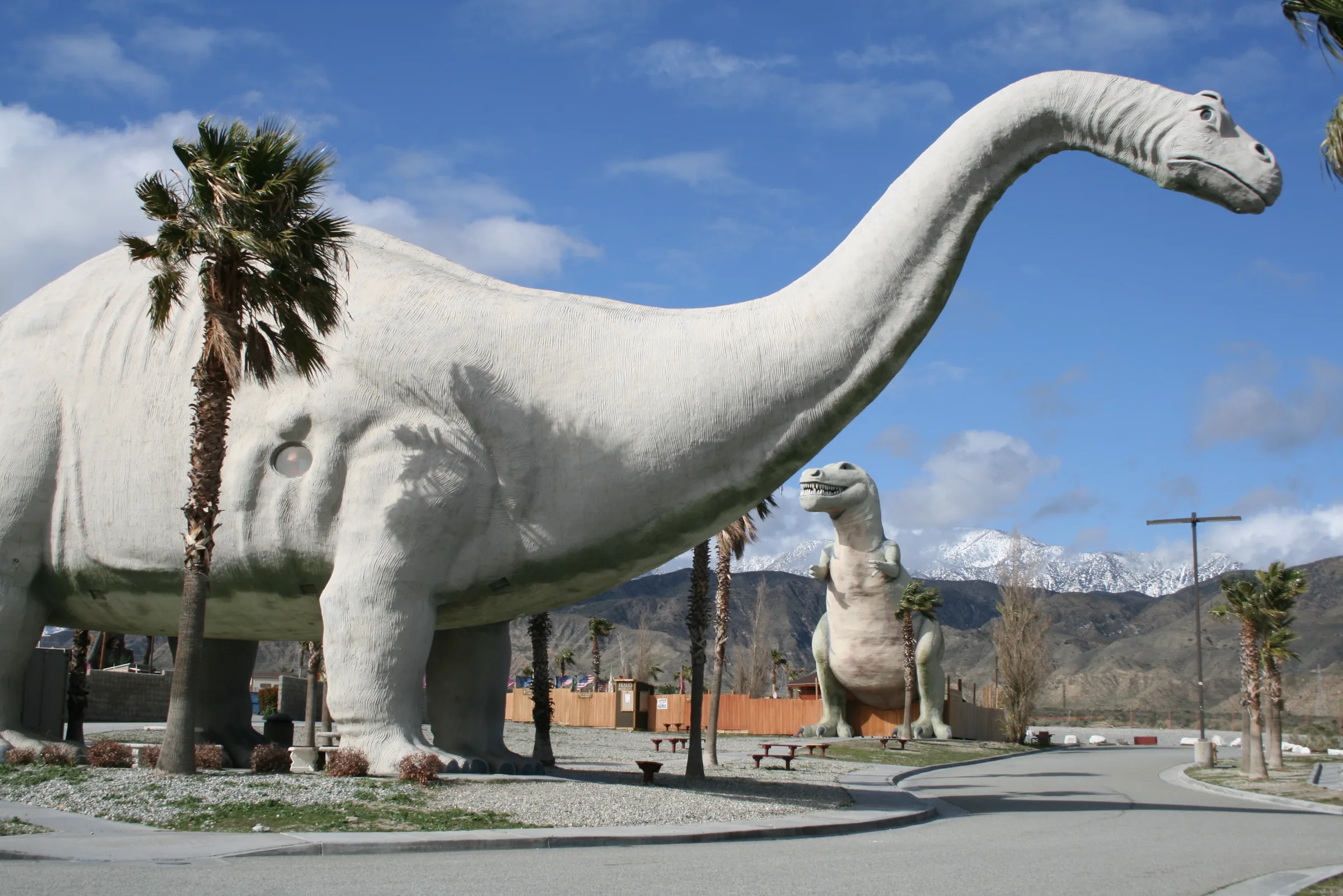
Orange County to Joshua Tree
Driving from Orange County to Joshua Tree: the 91, the 60 and I-10 to Highway 62, miles and drive time, the 91 Express Lanes, charging in Beaumont and stops.
Read →
San Diego to Joshua Tree
Driving from San Diego to Joshua Tree: I-15 and Highway 79, or the desert way through Julian, Anza-Borrego and the Salton Sea. Miles, times, charging and stops.
Read →